Oenoview

Oenoview, vine vigor assessment

Oenoview is a vine vigor assessment service. It operates using satellite images taken at ripening period (one image per year). Supported by advice from the French Cooperative Institute of the Wine (ICV), maps produced assist in harvest preparation, parcel selections, and groupings.

Data

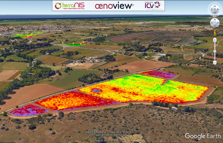
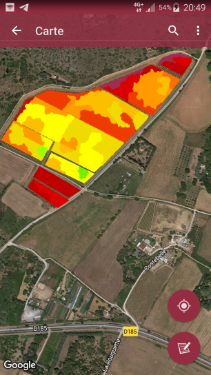
Oenoview provides images of GLCV (Green Leaf Cover Vegetation) on each parcels. It also offers intra-parcel zoning based on this index and inter-parcel differentiation.
These data are available in several formats: kml, shp, png, xls, and pdf in the form of parcel atlases. You can download them here by year: